Topographical maps - Kyrgyz Alpine Club

There is one thing that's better than mountains. It's mountains that we haven't climbed

Topographical maps

0 Comments

As for the Kyrgyz Republic, currently there is no substantial system or institution to publicly distribute up-to-date topographical maps. Decent alternatives include the classic Soviet military topographical maps, the OpenTopoMap available online, and handful of commercial maps, which covers some popular regions. We also prepare our original maps by virtue of GIS and open-source data, including topographical maps in the form of KMZ file intended for GPS devices.


Accessible and comprehensive topographical maps for Kyrgyzstan are either of out-dated but elaborate survey maps produced by the Soviet Army between 1950s-80s or OpenTopoMaps based on modern elevation data collected by space shuttle radar. While the latter is more precise with regard to the land configuration, the type of projection used for online maps (Web Mercator) are prone to yield discrepancy in distance; the former is thus more appropriate for practical navigation. Despite its obsoleteness, since soviet maps are generally more informative in terms of place names and other geographical objects, it is recommened to take advantage of both resources.

Soviet Military Topographical Map (SMTM)

Soviet Military Topographical Map (SMTM), also simply known as Soviet map or other names alike, is a once classified collection of topographical maps of the world that the Soviet Army manufactured during the postwar periods, which after the collapse of USSR came to public and now freely circulates on the earth. With the contemporary scientific knowledge and technology, the rather sophisticated maps, based on Gauss–Krüger (transverse Mercator) coordinate system, are presumably originally planned to cover the entire world at smaller scales (1:1M, 1:500,000, 1:200,000) and the territory of the former USSR at larger scales (1:100,000, 1:50,000, 1:25,000 etc.). There are a few websites that offer array of the map data, but none seems to hold the complete set of all items.

As for the Kyrgyz Republic, the state cartographic agency possess all the original topographical maps pertinent to the territory including those of the 1:25,000 scale, and corresponding data as well (both in raster and vector) thanks to a cooperative project with JICA, although it has not been made public yet. Under general circumstances, on the other hand, while sheets of 1:100,000 scale made in 1970s cover most of its territory, 1:50,000 sheets are only available sporadically, and 1:25,000 sheets are limited to certain strategic regions along the border. Each sheet of the maps is allocated identification code (such as “K44-XV-65-3”) in accordance with the logical system of dividing the world surface. Kyrgyzstan, as indicated in the chart below, falls into the major divisions of K42-44, J42-43. For detailed information on the symbology of the SMTM, refer to a careful report by the US Army: Soviet Topographic Map Symbols, 1959.

Soviet Military Topographical Maps scheme chart

DivisionNumberScaleRangeNote
Latitudinal sphereA-V (22) [Northern hemi.]
XA-XV (22) [Southern hemi.]
4º lat. height [0-88º]A and XA at the equator and V and XV by the poles
Standard divisionFor each sphere: 1-60[30]1: 1,000,000
(1cm: 10km)
4º lat. height × 6º lon. width*
[12º lon width above 60º lat.]
West longitude 180-0º: 1-30
East longitude 0-180º: 31-60
Major division1-4 (2×2)1: 500,000
(1cm: 5km)
2º lat. × 3º lon.Former USSR
Medium divisionI-XXXVI (6×6: 36)1: 200,000
(1cm: 2km)
74.08km × 1º lon.Eurasia, Africa, South America
Minor division1-144 (12×12)1: 100,000
(1cm: 1km)
37.04km × 0.5º lon.Europe, Former USSR (except some regions)
Major subdivision1-144: 1-4 (24×24)1: 50,000
(1cm: 500m)
18.52km × 0.25º lon.Eastern Europe, Western USSR

Each map is provided with grid lines whose unit length equals to 2cm in the north-south direction on the original material, whereas in the west-east direction, the value is not constant by nature.

The distance of one degree of longitude varies according to the correlating latitude. Along the 39.3ºN latitude where Lenin peak rises, for instance, a degree of longitude amounts to 86.14km, whereas along 42.8ºN where Bishkek lies, the same unit of longitude amounts to 81.68km

Attributes of SMTM

Since the Soviet agency engaged in the cartography no longer exists, the SMTM is apparently expected to be copyright free, although some claim it belongs to the Russian government, being the legitimate successor of the preceding regime. On the other hand, Ordnance Survey of UK, warns the commercial use of the SMTM for the Britain on the ground that corresponding maps themselves were plagiarized from their workpieces. In any case, no international agreement or affirmation seems to have made so far, and it is conventionally considered that there should be no critical issue in private or non-profit use of the maps such as mountaineering.

SMTM download

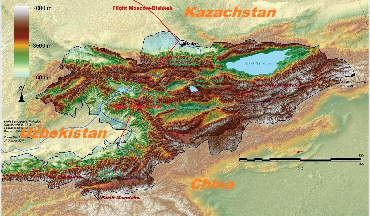
Collection of SMTM image data (either in JPG or GIF) for Kyrgyzstan is directly or indirectly available in following subsections.

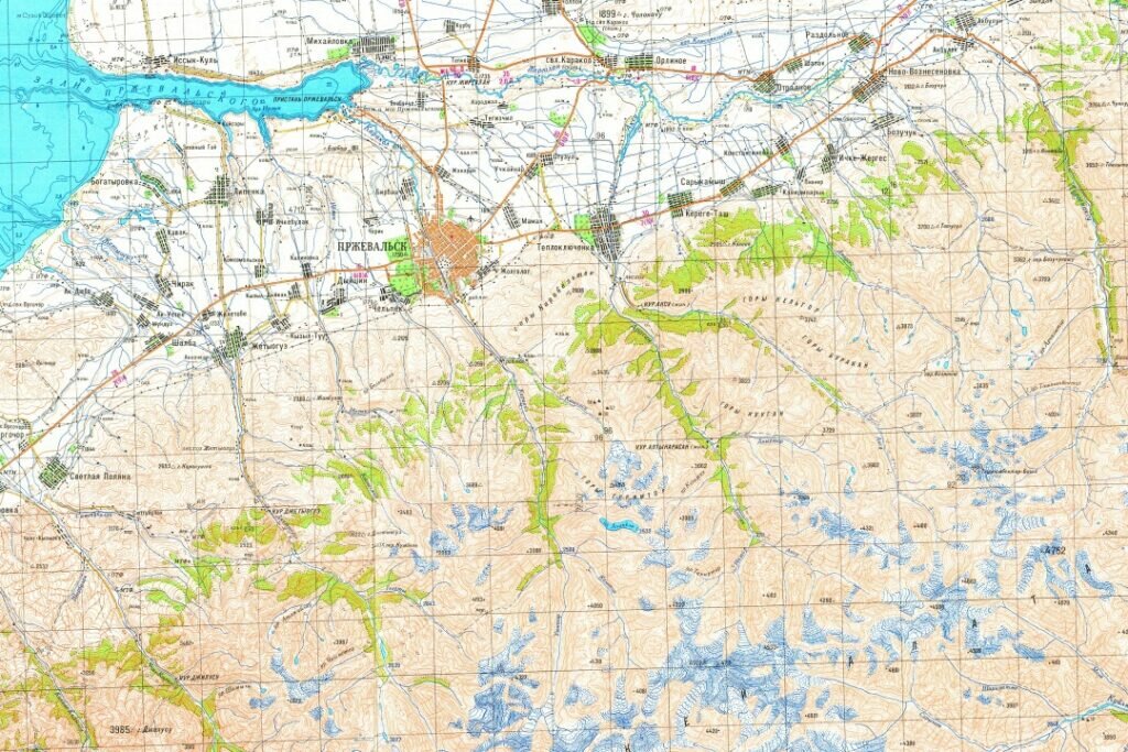
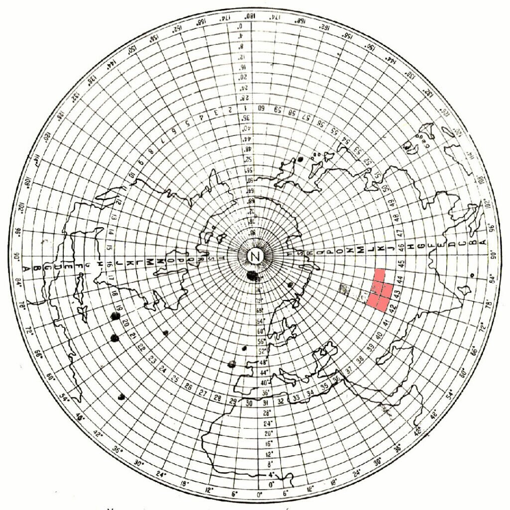
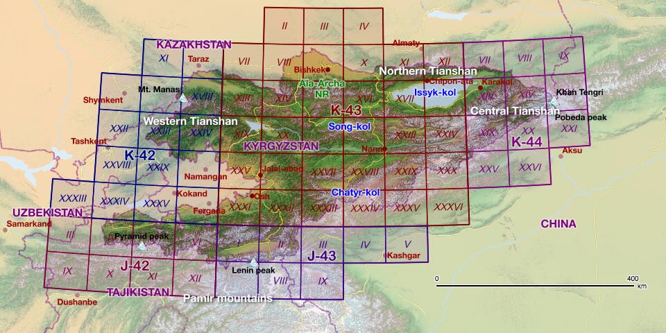
1:200,000 and 1:100,000 scale SMTM for Kyrgyzstan

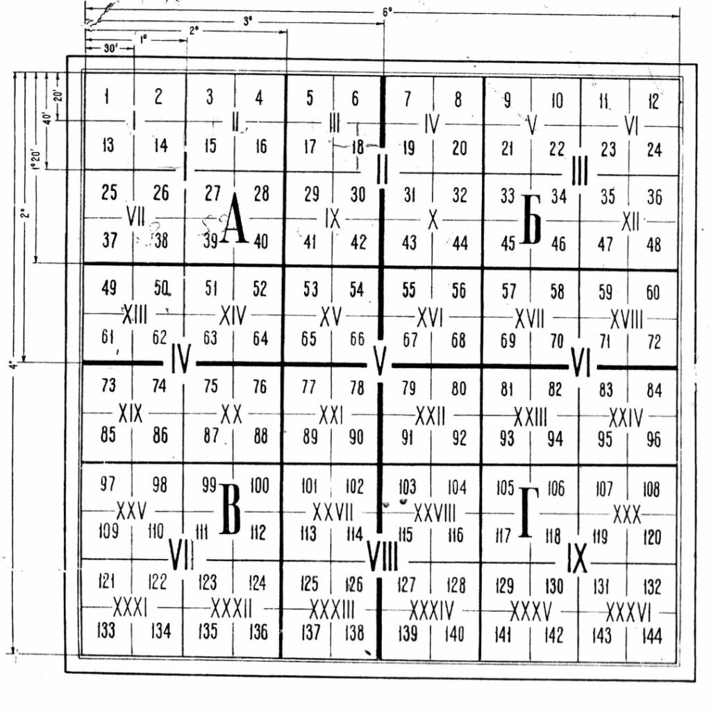
Download: Click one of grids in the map in order to download a set of five SMTM map images [one 1:200,000 sheet and four 1:100,000 sheets of the same medium division in GIF format] packed in a single ZIP file. Allocated number of 1:100,000 maps increments from north-west to south-east.

Note in some plots, one or two 1:100,000 items may be missing or are of older versions due to their absence. For printing, set the resolution to 198-200px/inch so as to achieve the original size of the material [37.04cm width]. Refer to the ▲chart above for more details about scaling.

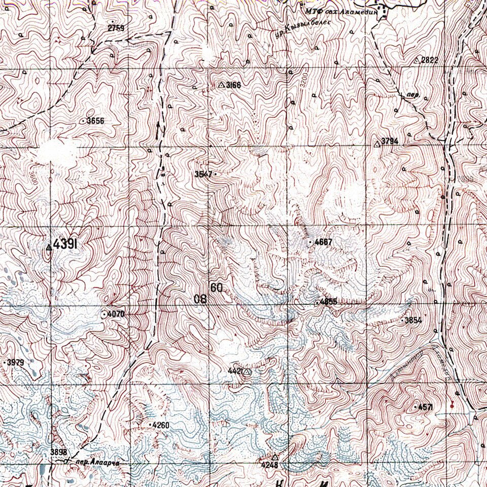
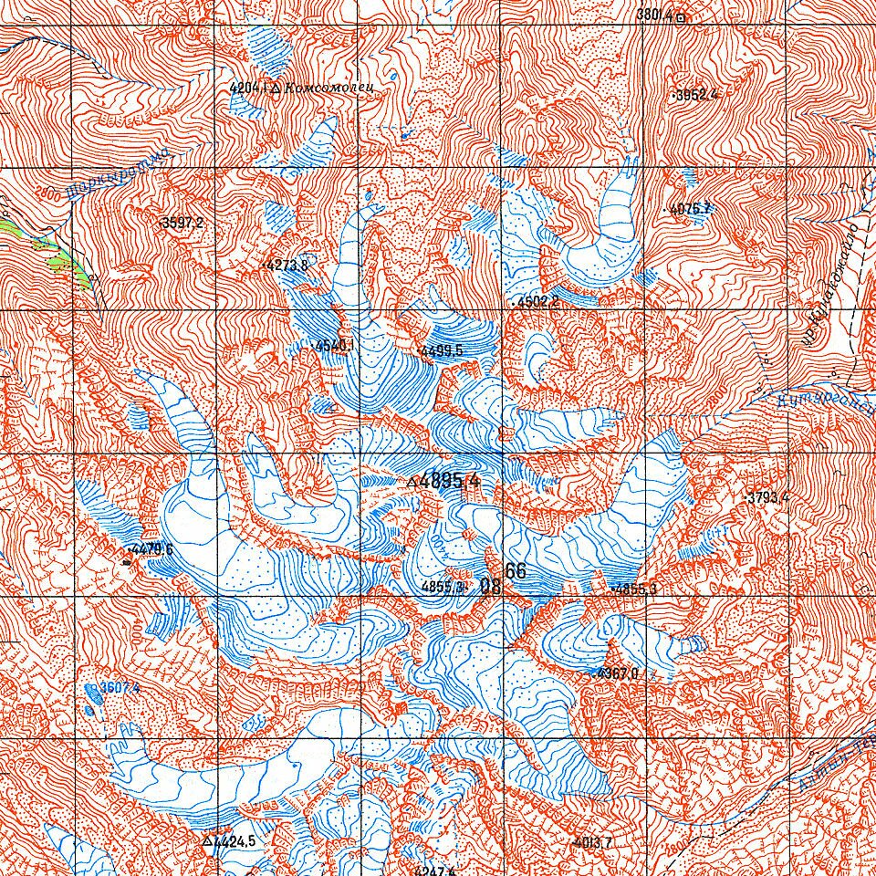
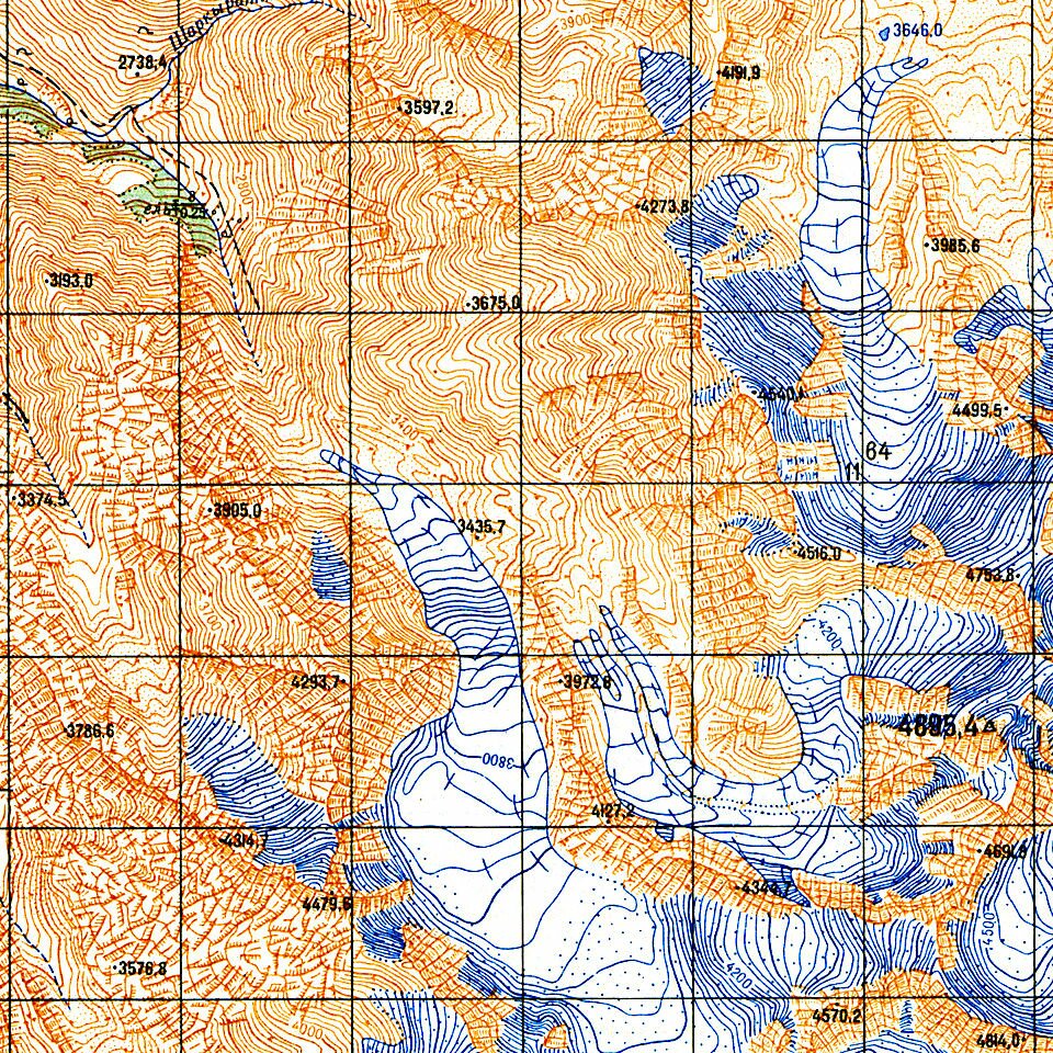
SMTM 1:20,000 of Kyrgyzstan
1:50,000 scale SMTM for Kyrgyzstan

Soviet maps of 1:50,000 scale are only partially available for the area of Kyrgyzstan, which emcompass following regions of outdoor interests: