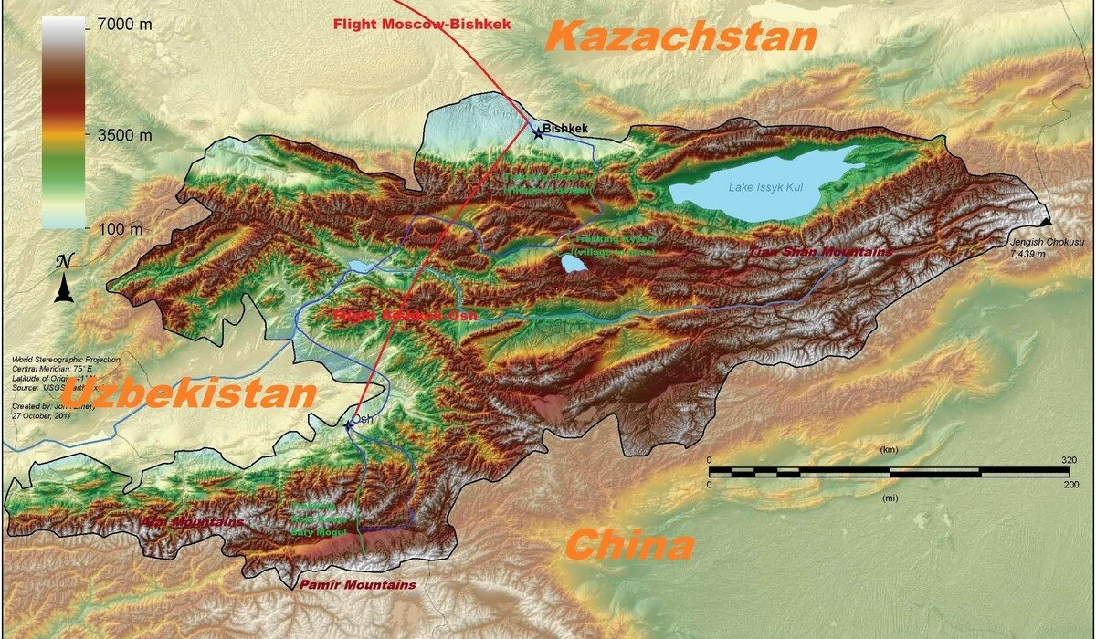
Countrywide maps of Kyrgyzstan Goskartografiya: geographical 1:1M, 2005 [JPG: 12.7MB] Goskartografiya: administrative 1:1M, 2003 [JPG: 7.9MB] US Army: geographical 1:1M, 1966 [JPGx4>ZIP: 29.2MB] Kyrgyz Concept tourist map [JPG: 10.8MB] Northern Tianshan Ala-archa National Nature Park Ala-archa and Ak-say valleys [JPGx4>ZIP: 22.6MB] Природный парк Ала-Арча | Ala-Archa Natural Park [1: 50,000] (Госкартография/ Goskartografiya, 1999) : Images taken […]
Category: Maps

Maps for GPS devices
Data formats of digital maps able to utilize with common GPS devices (such as of Garmin) include .img and .kmz: IMG (Garmin.img) file mainly consists of vector data and therefore relatively lightweight and suitable to cover large areas with contour lines, but if rendering from the original source is not appropriately done, the resulting display may not […]

General maps of Kyrgyzstan
In the Kyrgyz Republic, there is no substantial tourist information center operated by the government, and handy maps for visitors▼ are mostly offered at travel agencies specialized in organized tours or at some hostels. In general, it can be difficult to find, purchase, or print out actual maps in the country itself, so it is recommended […]

Orographic maps of Kygyzstan
The Orographic map represents detailed depiction of topographic reliefs or, especially in mountaineering, rather conceptual sketch that illustrates the relative disposition of mountain ridges and valleys, effectively used to describe the scene of the field adorned with some symbols to indicate prominent landmarks and routes. In orographic maps prepared by Kyrgyz Alpine Club based on […]

Commercial topographical maps
Topographical maps of any kind focused on Kyrgyzstan are very scarce compared to the situation in Europe or North America, and trekking or climbing maps with trails and routes are virtually nonexistent except for those in few Russian guidebooks. Following maps nevertheless encompass some popular regions of the country and may be worthwhile to possess: […]

OpenTopoMap
OpenTopoMap is an open-source online map put together by a voluntary team supported by the Friedrich-Alexander University of Erlangen-Nürnberg (FAU) in Germany, which consists of invaluable contour lines based on SRTM (Shuttle RADAR Topography Mission) DEM (Digital Elevation Model) published by NASA and supplemented with regularly updated geographic information by OpenStreetMap (OSM). Refer to the section of maps for GPS below […]

Topographical maps
As for the Kyrgyz Republic, currently there is no substantial system or institution to publicly distribute up-to-date topographical maps. Decent alternatives include the classic Soviet military topographical maps, the OpenTopoMap available online, and handful of commercial maps, which covers some popular regions. We also prepare our original maps by virtue of GIS and open-source data, including topographical maps in the […]


